
WestLat Connect pairs with the GNSS receivers you already own, mixed brands and all, over Bluetooth or WiFi. Set base or rover in a couple of taps, feed corrections from HPRTK, your CORS network, or a UHF base, and read live status. One app, not a utility per brand.
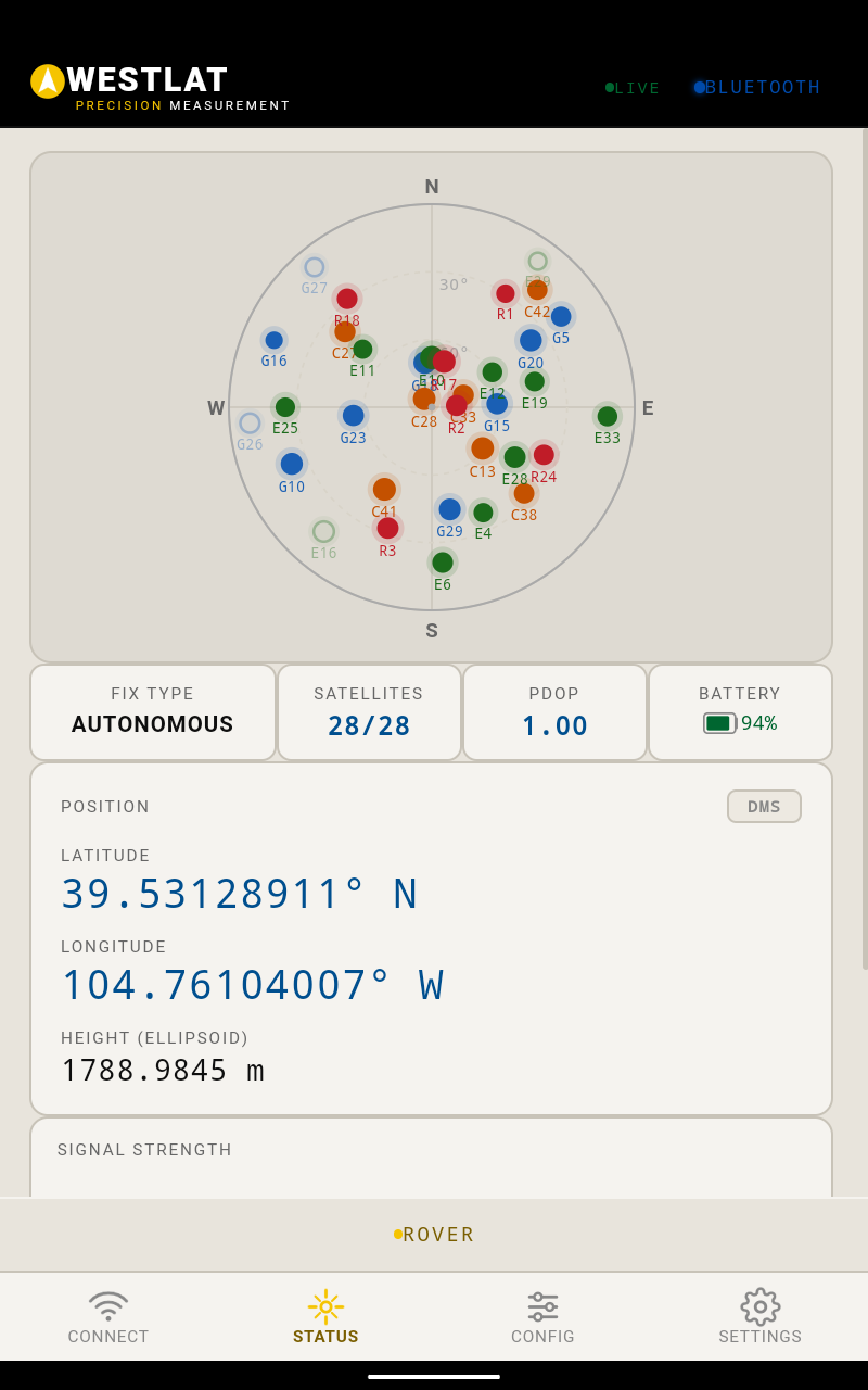
A field app that connects the receiver, sources the corrections, and dials in the radio, without a different utility for every brand.
Most crews run a mixed fleet, and every manufacturer ships its own setup tool. WestLat Connect replaces the pile: pair a receiver over Bluetooth or hop onto its WiFi network, set it as base or rover, point it at corrections, set antenna height, and watch a live status screen built for a tailgate, not a cubicle. It runs on the phone or tablet already in your truck.
This is the software pillar of WestLat, and it carries the same idea as the rest of the shop: work with the equipment you have, no rip-and-replace.
However your corrections arrive, the setup lives in the same app, on the same screen.
Bundle HPRTK network corrections with the app. One subscription, sign in, and the rover is fixed. No caster settings to babysit.
Already on a CORS network or another caster? Enter the credentials once and Connect handles the stream from there.
No coverage on site? Set a local base, broadcast over UHF, and match the rover's radio right from the app.
 Corrections In The Field
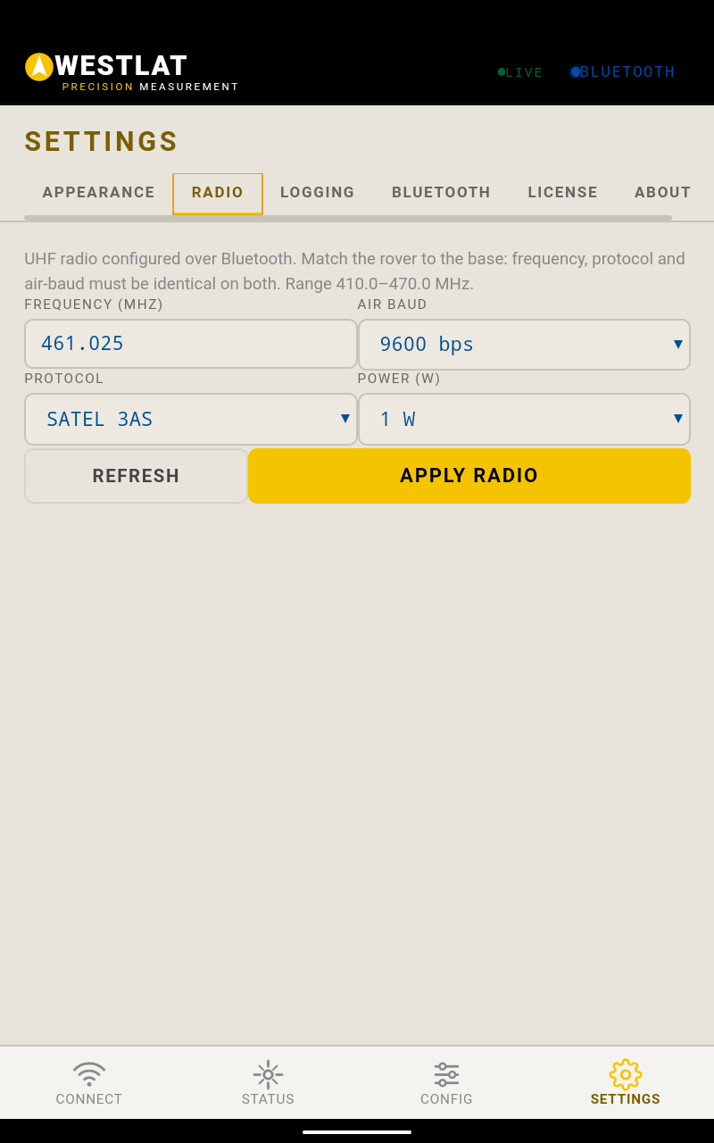
Corrections leave the base over UHF and land at the rover. The rule is simple: the two radios have to agree.
Connect, Status, Config, Settings. Everything a crew touches in the field, in one place.
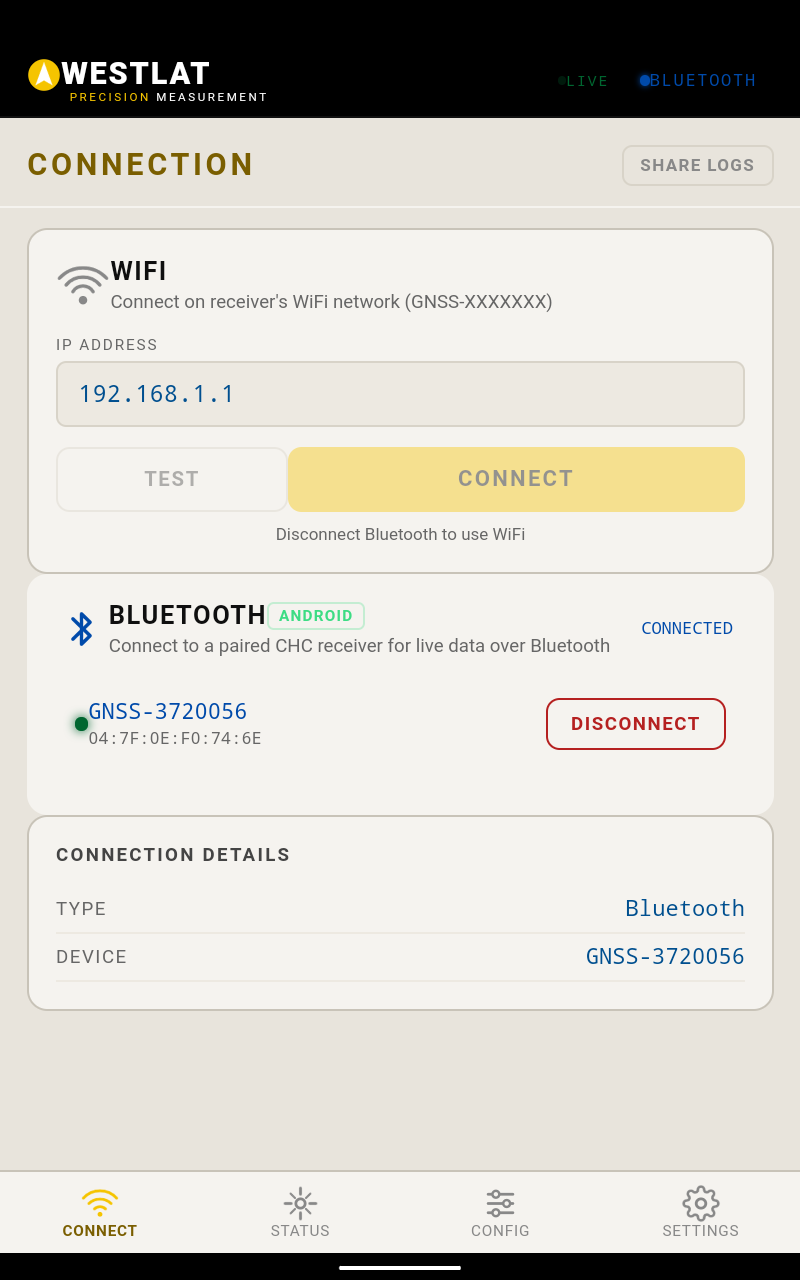
Pair the receivers in your fleet over Bluetooth, or join a receiver's WiFi network. Mixed brands, one app.
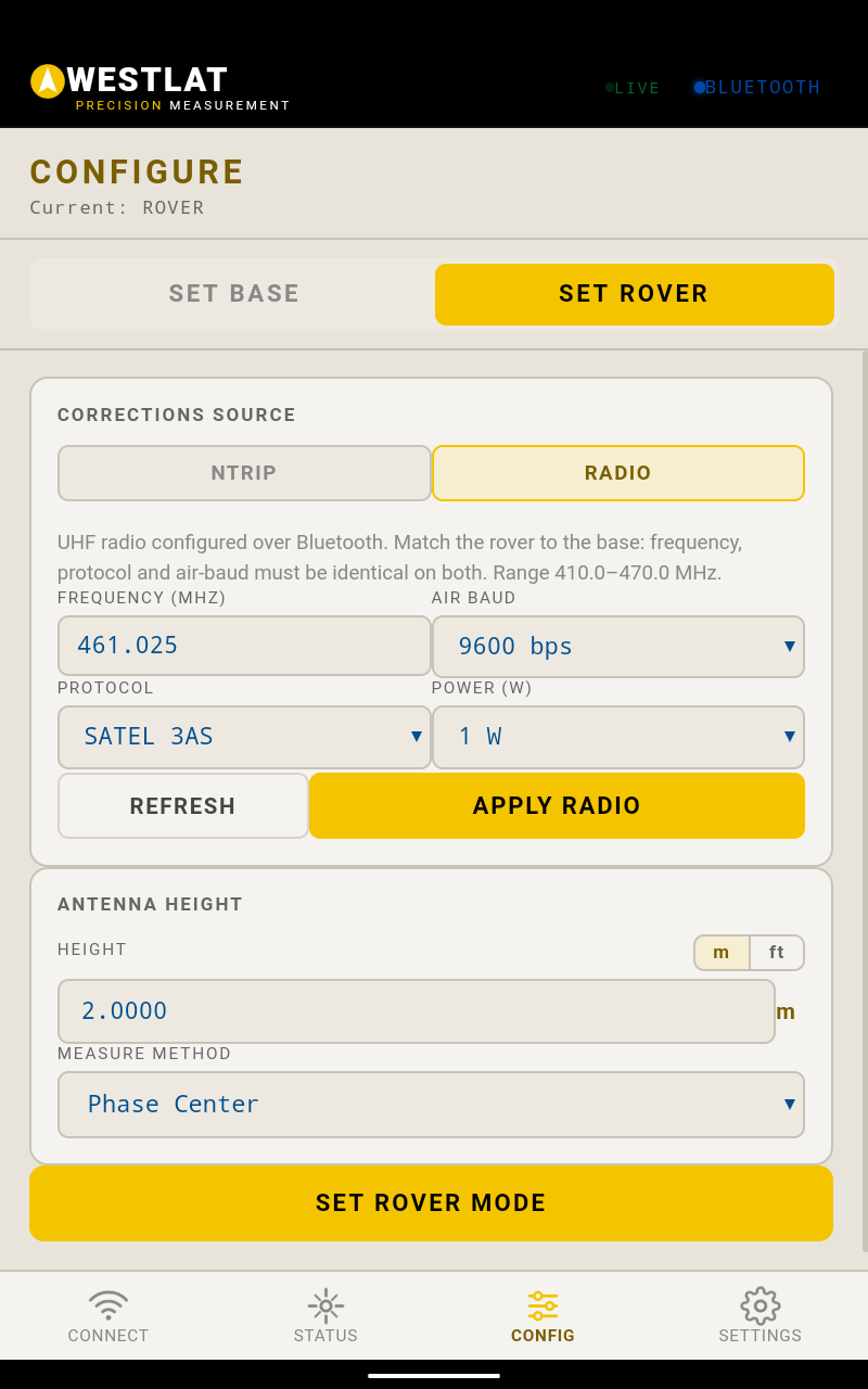
Set any receiver as base or rover, then point it at HPRTK, a caster, or a UHF radio for corrections.
Frequency, protocol, air baud, and power, set over Bluetooth and matched base to rover across brands.
Fix type, satellites tracked, PDOP, battery, and position, updating live with a satellite skyplot.
Bundled HPRTK service, your own CORS or NTRIP caster login, or a local base over UHF. Whichever the job calls for.
Set height and measure method (phase center and more) in metres or feet, so the numbers land true.